Community
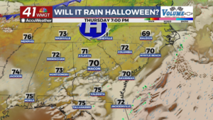
Rain odds for Halloweekend dropping
By Jared Lawson
Advertisement · Why this ad?
Jared Lawson, a graduate of the University of Alabama, has over five years of experience in community reporting, previously working for a neighborhood news site in Birmingham. He is dedicated to uncovering stories that connect and uplift the residents of Macon.
More from Jared →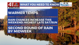
MACON, Georgia (41NBC/WMGT) A mid-level ridge continues to amplify over the area through Friday as high pressure anchored over the Appalachians keeps the status quo nice weather through the short term. Winds will continue out of the northeast as around 5-10 mph with a few low end gusts possible. There will be a general increase in cirrus clouds spreading across the region today ahead of our next developing weather system. Friday night, the ridge begins to dampen in response to a developing shortwave and associated trough digging into the ArkLaTex region, which will drive a change in the weather for our area by the second half of the weekend. Temperatures will run anywhere from 5 to 8 degrees above normal for this time of the year, over the next couple of days. Highs in the mid to upper 70s to low 80s and lows in the upper 40s to upper 50s. The long term picks up as a weak system is expected to work it s way through the Southeast. The GFS model has come into line with the Euro, sho
By Jared Lawson

By Rebecca Nash

By Margaret

By Rebecca Nash